Translate this page:
| Pincode | 515002 |
| Name | Parsannayapalli B.O |
| District | Ananthapur |
| State | Andhra Pradesh |
| Status | Branch Office(Delivery) |
| Head Office | Anantapur H.O |
| Sub Office | Anantapur Engg College S.O |
| Location | Anantapur Taluk of Ananthapur District |
| Telephone No | 8885155537 |
| SPCC | ANANTAPUR-515001 |
| Department Info | Anantapur Division Kurnool Region Andhra Pradesh Circle |
| Address | Anantapur, Andhra Pradesh, India |
| Services | |
| Indian Postal Code System Consists of Six digits. The first to digits represent the state, the second two digits represent the district and the Third two digits represents the Post Office.In this case the first two digits 51 represents the state Andhra Pradesh, the second two digits 50 represent the district Ananthapur, and finally 02 represents the Post Office Parsannayapalli B.O. Thus the Zip Code of Parsannayapalli B.O, Ananthapur, andhra pradesh is 515002 | |
| Pincode | 515002 |
| Name | Upparapalli B.O |
| District | Ananthapur |
| State | Andhra Pradesh |
| Status | Branch Office(Delivery) |
| Head Office | Anantapur H.O |
| Sub Office | Anantapur Engg College S.O |
| Location | Anantapur Taluk of Ananthapur District |
| Telephone No | 9177783281 |
| SPCC | ANANTAPUR-515001 |
| Department Info | Anantapur Division Kurnool Region Andhra Pradesh Circle |
| Address | Upparapalli, Andhra Pradesh 515002, India |
| Services | |
| Indian Postal Code System Consists of Six digits. The first to digits represent the state, the second two digits represent the district and the Third two digits represents the Post Office.In this case the first two digits 51 represents the state Andhra Pradesh, the second two digits 50 represent the district Ananthapur, and finally 02 represents the Post Office Upparapalli B.O. Thus the Zip Code of Upparapalli B.O, Ananthapur, andhra pradesh is 515002 | |
| Pincode | 515002 |
| Name | Bramhanayaleru B.O |
| District | Ananthapur |
| State | Andhra Pradesh |
| Status | Branch Office(Delivery) |
| Head Office | Anantapur H.O |
| Sub Office | Anantapur Engg College S.O |
| Location | Anantapur Taluk of Ananthapur District |
| Telephone No | 9959135580 |
| SPCC | ANANTAPUR-515001 |
| Department Info | Anantapur Division Kurnool Region Andhra Pradesh Circle |
| Address | Anantapur, Andhra Pradesh, India |
| Services | |
| Indian Postal Code System Consists of Six digits. The first to digits represent the state, the second two digits represent the district and the Third two digits represents the Post Office.In this case the first two digits 51 represents the state Andhra Pradesh, the second two digits 50 represent the district Ananthapur, and finally 02 represents the Post Office Bramhanayaleru B.O. Thus the Zip Code of Bramhanayaleru B.O, Ananthapur, andhra pradesh is 515002 | |
| Pincode | 515002 |
| Name | Bukkacherla B.O |
| District | Ananthapur |
| State | Andhra Pradesh |
| Status | Branch Office(Delivery) |
| Head Office | Anantapur H.O |
| Sub Office | Anantapur Engg College S.O |
| Location | Anantapur Taluk of Ananthapur District |
| Telephone No | 9010316250 |
| SPCC | ANANTAPUR-515001 |
| Department Info | Anantapur Division Kurnool Region Andhra Pradesh Circle |
| Address | Anantapur, Andhra Pradesh, India |
| Services | |
| Indian Postal Code System Consists of Six digits. The first to digits represent the state, the second two digits represent the district and the Third two digits represents the Post Office.In this case the first two digits 51 represents the state Andhra Pradesh, the second two digits 50 represent the district Ananthapur, and finally 02 represents the Post Office Bukkacherla B.O. Thus the Zip Code of Bukkacherla B.O, Ananthapur, andhra pradesh is 515002 | |
| Pincode | 515002 |
| Name | Alamuru B.O |
| District | Ananthapur |
| State | Andhra Pradesh |
| Status | Branch Office(Delivery) |
| Head Office | Anantapur H.O |
| Sub Office | Anantapur Engg College S.O |
| Location | Anantapur Taluk of Ananthapur District |
| Telephone No | 9985834678 |
| SPCC | ANANTAPUR-515001 |
| Department Info | Anantapur Division Kurnool Region Andhra Pradesh Circle |
| Address | Alamur, Andhra Pradesh 515002, India |
| Services | |
| Indian Postal Code System Consists of Six digits. The first to digits represent the state, the second two digits represent the district and the Third two digits represents the Post Office.In this case the first two digits 51 represents the state Andhra Pradesh, the second two digits 50 represent the district Ananthapur, and finally 02 represents the Post Office Alamuru B.O. Thus the Zip Code of Alamuru B.O, Ananthapur, andhra pradesh is 515002 | |
| Pincode | 515002 |
| Name | Anantapur Engg College S.O |
| District | Ananthapur |
| State | Andhra Pradesh |
| Status | Sub Office(Delivery) |
| Head Office | Anantapur H.O |
| Sub Office | |
| Location | Anantapur Taluk of Ananthapur District |
| Telephone No | 8554272850 |
| SPCC | ANANTAPUR-515001 |
| Department Info | Anantapur Division Kurnool Region Andhra Pradesh Circle |
| Address | Department of Electrical Engineering, JNTU Anantapur, Anantapur, Andhra Pradesh 515002, India |
| Services | EMS (International Speed Post) E-Payment Inland Speed Post Instant Money Order International Mails Money Order Postal Banking Service Postal Life Insurance Postal Stationary Registered Posts |
| Indian Postal Code System Consists of Six digits. The first to digits represent the state, the second two digits represent the district and the Third two digits represents the Post Office.In this case the first two digits 51 represents the state Andhra Pradesh, the second two digits 50 represent the district Ananthapur, and finally 02 represents the Post Office Anantapur Engg College S.O. Thus the Zip Code of Anantapur Engg College S.O, Ananthapur, andhra pradesh is 515002 | |
| Pincode | 515002 |
| Name | Kakkalpalli B.O |
| District | Ananthapur |
| State | Andhra Pradesh |
| Status | Branch Office(Delivery) |
| Head Office | Anantapur H.O |
| Sub Office | Anantapur Engg College S.O |
| Location | Anantapur Taluk of Ananthapur District |
| Telephone No | 9652092049 |
| SPCC | ANANTAPUR-515001 |
| Department Info | Anantapur Division Kurnool Region Andhra Pradesh Circle |
| Address | Anantapur, Andhra Pradesh, India |
| Services | |
| Indian Postal Code System Consists of Six digits. The first to digits represent the state, the second two digits represent the district and the Third two digits represents the Post Office.In this case the first two digits 51 represents the state Andhra Pradesh, the second two digits 50 represent the district Ananthapur, and finally 02 represents the Post Office Kakkalpalli B.O. Thus the Zip Code of Kakkalpalli B.O, Ananthapur, andhra pradesh is 515002 | |


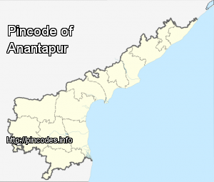
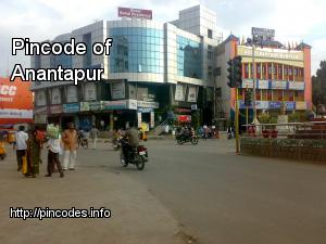
Anantapur is a city in Anantapur district of the Indian state of Andhra Pradesh. It is a municipal corporation and the headquarters of Anantapur mandal. It lies on NH-7. It was the headquarters of the "Datta Mandalam" (Rayalaseema districts of Andhra Pradesh and Bellary district of Karnataka) in 1799 and Sir Thomas Munro was the first collector for ceded districts. It was also a position of strategic importance for the British Indian Army during the Second World War.
Ananthapur is located at 14.68°N 77.6°E / 14.68; 77.6. It has an average elevation of 335 metres (1099 feet).
Anantapur has a semi-arid climate, with hot and dry conditions for most of the year. Summers start in late February and peak in May with average high temperaturesMore Info